
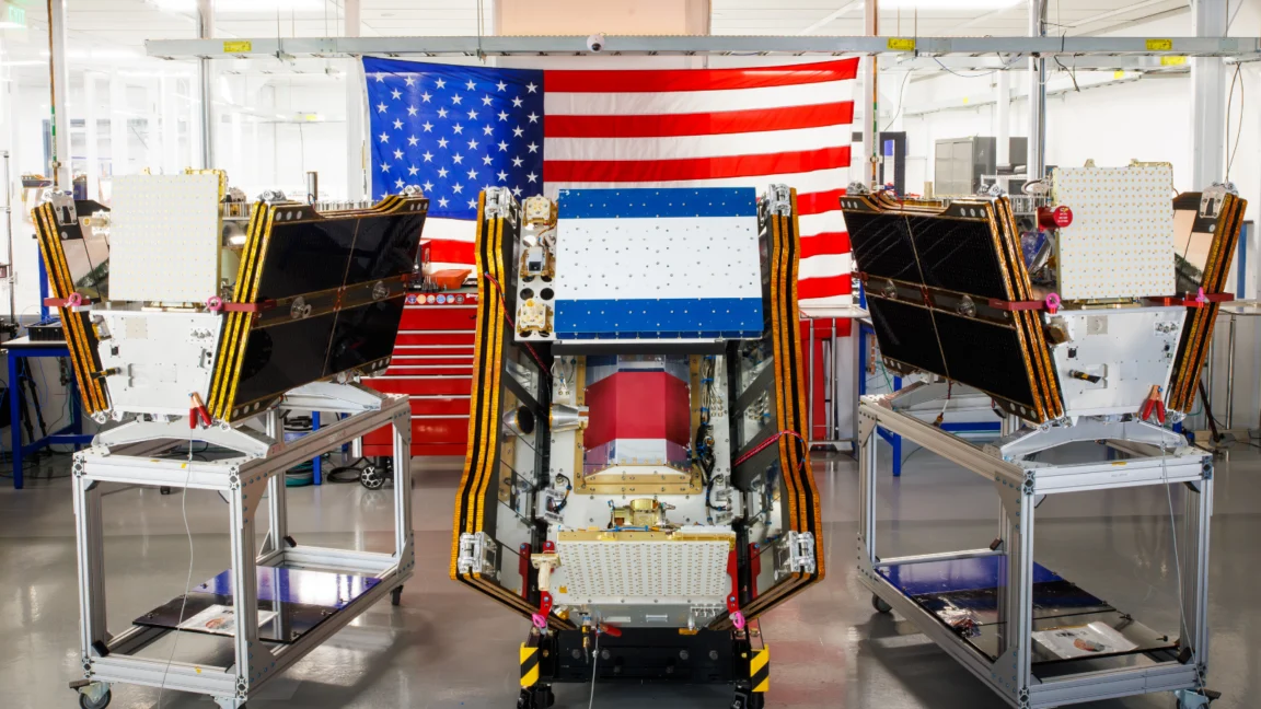
The global effort to monitor and mitigate the escalating threat of wildfires reached a significant milestone on July 7, 2026, as the first three operational satellites of the FireSat constellation were successfully deployed into orbit. Launched aboard a SpaceX Falcon 9 rocket from Vandenberg Space Force Base in California, these microsatellites represent the vanguard of a specialized orbital network designed to detect nascent wildfires with unprecedented precision. Managed by the nonprofit Earth Fire Alliance (EFA) and bolstered by significant financial and technical backing from Google and the Bezos Earth Fund, the FireSat program aims to fill a critical gap in current Earth-observation capabilities, offering the potential to identify blazes long before they escalate into uncontrollable conflagrations.
The launch occurs at a moment of acute environmental crisis. As the satellites reached their orbital slots, vast swaths of North America remained shrouded in smoke from hundreds of active wildfires burning across the Canadian boreal forests and the Western United States. This new orbital infrastructure is expected to transition to "initial operational capability" following a three-month commissioning and testing phase. By the final quarter of 2026, the trio of satellites will begin providing high-resolution thermal data to fire agencies in high-risk regions, including California, Colorado, Australia, and Portugal.
Technical Specifications and the Power of High-Resolution Detection
The FireSat constellation is the first satellite array purpose-built specifically for wildfire intelligence. Unlike existing environmental satellites, such as the MODIS or VIIRS instruments operated by NASA and NOAA—which often have thermal resolutions ranging from 375 meters to one kilometer—FireSat utilizes advanced multispectral imaging technology developed by California-based Muon Space. This technology allows the satellites to detect heat signatures from fires as small as five by five meters (approximately 16 by 16 feet) on the ground.
This granular level of detection is a transformative leap for emergency responders. Most current satellite systems are optimized for broad weather patterns or large-scale land use changes, meaning they often miss small "spot fires" or low-intensity blazes until they have grown large enough to produce significant smoke plumes. FireSat’s sensors are specifically tuned to peer through thick smoke and heavy cloud cover, identifying the infrared "fingerprint" of a fire in its infancy.

The efficacy of this hardware was validated during a rigorous pilot phase. A "Protoflight" satellite launched in March 2025 collected more than one million images over a year of testing. During this period, the prototype successfully identified numerous low-intensity fires that remained invisible to conventional satellite monitoring systems. This proof-of-concept paved the way for the $15 million in funding provided by Google Research and a substantial $26 million commitment from the Bezos Earth Fund to accelerate the deployment of the full constellation.
A Chronology of Deployment and Future Goals
The FireSat program is structured around an aggressive multi-year deployment timeline aimed at achieving near-real-time global monitoring. The July 2026 launch marks the beginning of the operational phase, but it is only the first step in a broader strategic rollout.
- March 2025: Launch of the FireSat Protoflight. This mission served as the technical testbed, proving that multispectral sensors could accurately distinguish between actual fire starts and "false positives" like sun glint or industrial heat sources.
- July 2026: Launch of the first three operational microsatellites. These units will provide twice-daily coverage of every fire-prone region on Earth.
- Late 2026: Integration of data into the workflows of "early adopter" fire agencies. This phase focuses on refining the user interface for firefighters on the ground.
- 2029: The constellation is expected to grow sufficiently to provide hourly imagery updates for any point on the globe.
- Early 2030s: Completion of the full constellation, consisting of more than 50 satellites. At this stage, the revisit rate—the time between a satellite passing over the same spot—will drop to just 20 minutes.
This rapid revisit rate is essential for modern firefighting. In arid, wind-driven environments, a fire can grow from a small spark to a massive crown fire in less than an hour. Reducing the "blind spot" between satellite passes is seen by experts as the most effective way to improve initial attack success rates.
Economic and Environmental Implications
The Earth Fire Alliance has released detailed projections regarding the potential impact of the FireSat network. According to their modeling, achieving even an hourly revisit rate could result in more than $1 billion in avoided fire damage costs globally. By enabling faster suppression, the system is projected to protect approximately 1.3 million acres of land and 3,500 homes annually that would otherwise be lost to late-detected fires.
Furthermore, the environmental benefits are substantial. Wildfires are a major source of greenhouse gas emissions, often creating a feedback loop that accelerates global warming. The EFA estimates that the FireSat constellation could prevent nearly 22 million tons of carbon emissions per year by limiting the scale of catastrophic burns. This is particularly relevant for peatlands and boreal forests, which store vast amounts of carbon that are released into the atmosphere when they burn.

Google’s involvement extends beyond mere financing. Google Research is deploying custom AI models to process the massive influx of data from Muon Space’s satellites. These AI systems compare real-time FireSat data against decades of historical satellite imagery to identify anomalies. By automating the detection process, the AI can alert local authorities to a potential fire within minutes of the satellite pass, removing the bottleneck of human image analysis.
The AI Paradox: Climate Solution vs. Climate Cost
While Google has framed its support for FireSat as a "tangible step forward in putting practical AI to work for climate resilience," the project also highlights a growing tension within the tech industry. The very AI models used to detect wildfires require an immense amount of energy to train and operate.
Recent reports indicate that the boom in AI data centers is driving a significant surge in electricity demand. Google acknowledged that its company-wide electricity usage grew by 37 percent in 2025 alone, largely due to the infrastructure required for generative AI. In many regions, this increased demand is being met by new natural gas projects, which could collectively emit more than 129 million tons of greenhouse gases annually.
Critics and environmental analysts point out the irony: the tech industry is developing sophisticated tools to manage the symptoms of climate change (such as increased wildfires) while simultaneously contributing to the primary cause (carbon emissions) through its energy-intensive expansion. Google has stated it remains committed to its goal of reaching net-zero emissions across its operations by 2030, but the rapid growth of AI has made that target increasingly difficult to hit.
The Crisis on the Ground: Lessons from the 2026 Fire Season
The urgency of the FireSat mission is underscored by the current state of wildfires in the Northern Hemisphere. As of mid-July 2026, the Canadian Wildland Fire Information System reported nearly 900 active wildfires, with over 3,600 fires recorded since the start of the year. These blazes have already consumed more than 6.6 million acres.

In Ontario and British Columbia, dozens of "out of control" fires are currently being monitored rather than fought. Fire agencies, overwhelmed by the sheer number of starts, have been forced to triage their resources, focusing only on blazes that directly threaten lives or critical infrastructure. This "managed fire" approach is a direct result of limited resources, including a shortage of heavy-lift helicopters and fixed-wing air tankers.
Werner Kurz, a retired senior research scientist at Natural Resources Canada, noted that the traditional strategies of fire suppression are being overwhelmed by the new reality of a hotter, drier climate. "What is unfolding is what climate and forest scientists have been predicting for 30 years," Kurz stated. He emphasized that while better detection via satellites like FireSat is a vital tool, it must be paired with increased ground resources and more aggressive forest management, such as prescribed burns, to reduce the fuel loads that allow small fires to become mega-fires.
Broader Impact and the Path Forward
The FireSat program represents a shift toward a more proactive, tech-driven approach to disaster management. By providing international fire agencies with high-fidelity, low-latency data, the Earth Fire Alliance hopes to democratize access to advanced space technology. Historically, only the wealthiest nations could afford dedicated orbital monitoring; the FireSat model aims to provide this data to fire-prone regions globally, regardless of their domestic space capabilities.
However, as the first three satellites begin their work, the limitations of technology remain clear. Detection is only the first link in the chain of survival. For the FireSat data to be effective, it must be integrated into a robust emergency response network that includes well-funded fire departments, advanced aerial firefighting fleets, and communities that are prepared for evacuations.
As smoke continues to affect air quality for more than 100 million people across North America, the launch of FireSat serves as both a beacon of technological hope and a sobering reminder of the scale of the climate challenge. The success of the program will ultimately be measured not by the number of satellites in orbit, but by the number of fires that are extinguished while they are still small enough to be controlled.

